The Virgin River: Headwaters to Lake Mead
While not as well known as the mighty Mississippi or the grand Colorado rivers, the Virgin River has played a significant role in carving one of the most visited landscapes in the United States. It also provides a critical resource for life along its route.
By: Melinda Bennion/Utah Division of Wildlife Resources
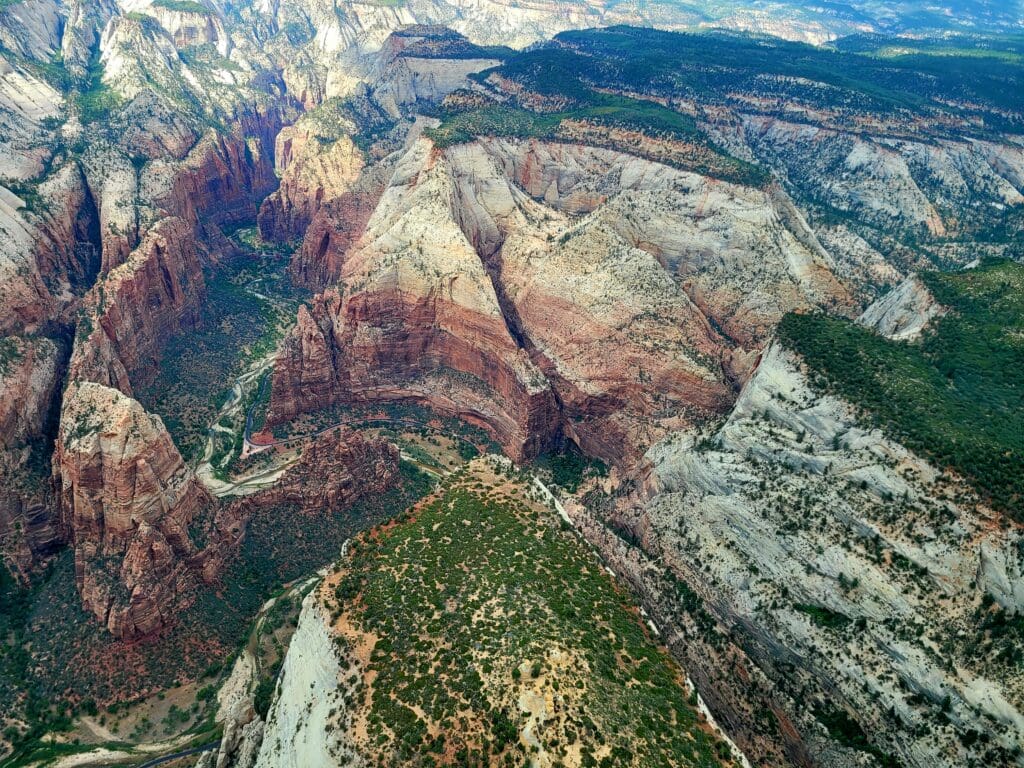
The North Fork of the Virgin River begins its journey where an underground river emerges from the face of a colorful sandstone cliff, at Cascade Falls just North of Zion National Park. Geologic uplift and the persistent erosion of the river have cut through Navajo Sandstone forming the iconic slot canyon of the Narrows. As the river flows deeper through the main canyon of Zion National park it cuts deeper, eroding through softer layers below the Navajo sandstone. This undercutting causes the Navajo Sandstone to fracture and collapse, widening the canyon and forming the iconic sheer cliffs of Zion. The East Fork of the Virgin River flows through Mount Carmel Junction and the east side of Zion before converging with the North Fork to form the Virgin River. Nineteen miles of the Virgin River and smaller tributaries in and near Zion National Park have been designated as Wild and Scenic Rivers. Each of these sections are managed to protect water quality and free flow. As the Virgin River travels to the southwest, it continues to grow as several more tributaries flow in. Ash Creek, LaVerkin Creek, North Creek and the Santa Clara River merge with the Virgin River before it enters the Virgin River Gorge, where it leaves Utah and flows through the Northwestern corner of Arizona into Nevada. Historically the Virgin River became a tributary of the Colorado river, however in 1936 the Hoover Dam was completed. As water levels at Lake Mead rose, the confluence of the Virgin River and the Colorado river flooded. Today the Virgin River ends as its waters flow into Lake Mead.
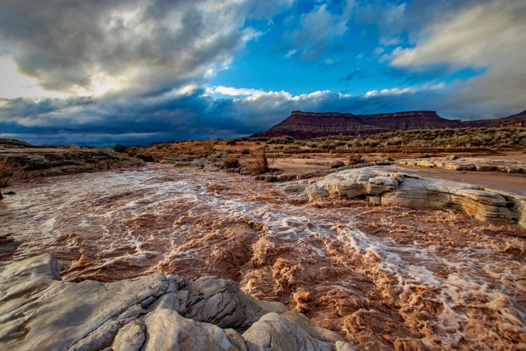
Most of the year the river flows fairly clear, with water usually low enough to wade across. High spring flows from snowmelt are important to trigger spawning for native fish and deposit substrate (e.g., gravel, cobble) perfect for fish eggs to develop. Our rocky desert terrain with few plants and thin soil means most rain water flows across the surface instead of soaking down. After heavy rainstorms, water collects together forming strong currents that carry sediments downstream in a muddy rush, carving canyons and rolling boulders in flash floods. Native plants and animals have adapted to survive strong flooding. Willows are able to bend with most floods and stand back up as the water drops. Local beaver often burrow into the banks of the river, and only construct dams and lodges on quieter tributaries. Fish find refuge in slower eddies and backwaters to withstand the torrent. Early pioneer settlers were sometimes surprised at the ferocity of the flash floods, and lost homes to the river. The historic ghost town of Grafton was abandoned in part due to the struggle of living next to a river prone to flash flooding. During one such flood, a mother giving birth had to be rescued, which prompted his parents to name the baby Marvelous Flood Tenny.
Falls Park, Virgin River, Virgin, UT
By: Shawn Green
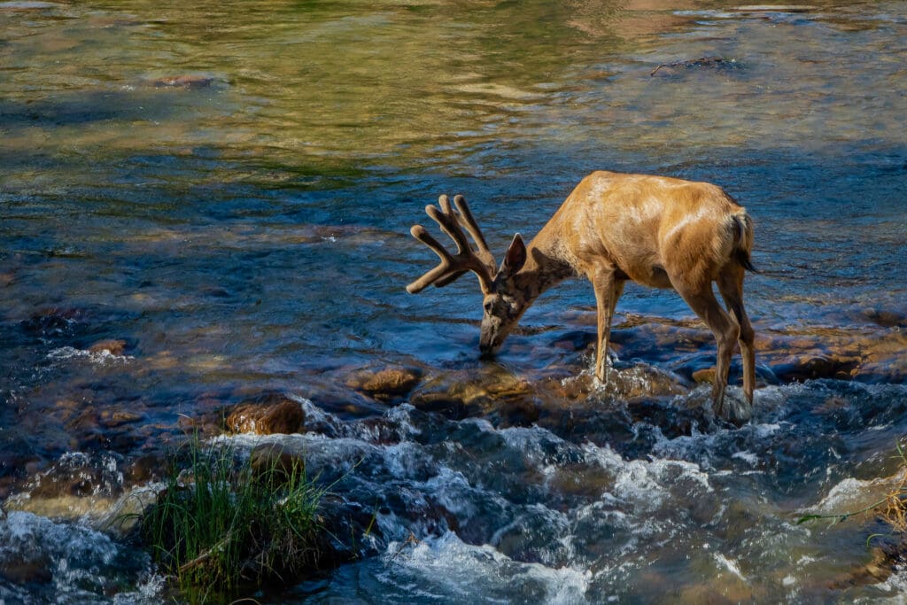
Much of the rich biodiversity of the Virgin River basin occurs within riparian areas. Plants unable to tolerate desert conditions are able to flourish along the river as far out as roots are able to find water. There is an abrupt change in vegetation at this boundary, visible in aerial photos as a green riparian zone that follows the river’s course. Many wildlife species are dependent on the cooler, wetter habitat provided by the shade of willow and cottonwood. Only a few meters further from the riparian zone’s edge, conditions become harsh enough that only creatures and plants with special adaptations are able to survive. From ancient times to today, the waters of the Virgin River have been vitally important to human life in the desert. Early people relied on water and food found near the river, and today communities nearby use the Virgin River as their primary water source.
By: Shawn Green
Pressures on the Virgin River have never been higher. Water needed for local communities is moved by eight diversion dams into reservoirs for home, industrial, agricultural, and recreational use. The Quail Creek Diversion Dam pipes water through the Hurricane Hydroelectric Power Plant, and from there the water is moved to Quail Creek and Sand Hollow reservoirs. The Virgin River Program brings partners and agencies together to protect native wildlife along the Virgin River while taking into account the needs and growth of local communities. Native fish have benefited through actions of the Virgin River Program including managing water releases during times of low flows, removing non-native fish, installing fish screens to allow fish to bypass diversions, and native fish monitoring and stocking. Protection and restoration of floodplain habitat provides critical nesting areas for birds like the Southwestern Willow Flycatcher and benefits other wildlife. By working together, we can ensure the Virgin River continues to meet the needs of both people and wildlife, now and for the future.